
File:The church of St.Mary Magdalen, Davington - geograph.org.uk - 1276737.jpg
No higher resolution available.
The_church_of_St.Mary_Magdalen,_Davington_-_geograph.org.uk_-_1276737.jpg (640 × 480 pixels, file size: 99 KB, MIME type: image/jpeg)
Captions
Captions
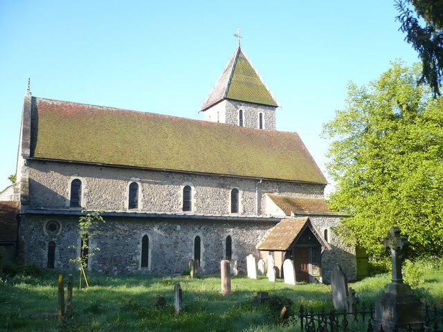
The church of St.Mary Magdalene, Davington
Summary
[edit]
| Description |
English: The church of St.Mary Magdalen, Davington Taken in the early morning sunshine. It was originally part of Davington Priory, a medieval nunnery founded over 855 years ago. There is another part of the priory still standing, attached to the south of the church. It is now a private residence. |
| Date | |
| Source | From geograph.org.uk |
| Author | pam fray |
| Camera location | | View this and other nearby images on: OpenStreetMap |
|---|
_heading:247.00&language=en)
| Object location | | View this and other nearby images on: OpenStreetMap |
|---|
_heading:247.00&language=en)
Licensing
[edit]

|
This image was taken from the Geograph project collection. See this photograph's page on the Geograph website for the photographer's contact details. The copyright on this image is owned by pam fray and is licensed for reuse under the Creative Commons Attribution-ShareAlike 2.0 license.
|
This file is licensed under the Creative Commons Attribution-Share Alike 2.0 Generic license.
Attribution: pam fray
- You are free:
- to share – to copy, distribute and transmit the work
- to remix – to adapt the work
- Under the following conditions:
- attribution – You must give appropriate credit, provide a link to the license, and indicate if changes were made. You may do so in any reasonable manner, but not in any way that suggests the licensor endorses you or your use.
- share alike – If you remix, transform, or build upon the material, you must distribute your contributions under the same or compatible license as the original.
File history
Click on a date/time to view the file as it appeared at that time.
| Date/Time | Thumbnail | Dimensions | User | Comment | |
|---|---|---|---|---|---|
| current | 04:07, 27 February 2011 | | 640 × 480 (99 KB) | GeographBot (talk | contribs) | == {{int:filedesc}} == {{Information |description={{en|1=The church of St.Mary Magdalen, Davington Taken in the early morning sunshine. It was originally part of Davington Priory, a medieval nunnery founded over 855 years ago. There is another part of the |
You cannot overwrite this file.
File usage on Commons
The following 2 pages use this file:
File usage on other wikis
The following other wikis use this file:
- Usage on cy.wikipedia.org
- Usage on en.wikipedia.org
- Usage on sv.wikipedia.org
- Usage on www.wikidata.org